WanderLearn Podcast
Check out the latest WanderLearn episodes!
Take a profound and distant journey. Call it:
- Deep Travel
- Immersive Travel
- Slow Travel
- Vagabonding
I will guide you to the intersection of travel, technology, and transformation.
The WanderLearn podcast will compel you to go beyond your comfort zone.
I wander all over the world and I share what I learn with you! In so doing, I hope you'll be inspired to do the same. Travel is the best university.
How to Subscribe to the WanderLearn Podcast
Search for "WanderLearn" in your favorite podcast player.

![]()
 If that fails:
This email address is being protected from spambots. You need JavaScript enabled to view it. with the details of what podcast player failed to find the show.- While I fix the problem, copy and paste this feed into your favorite podcast player:
https://wanderlearn.podbean.com/feed.xml
Although subscribing is important, two other things really help the WanderLearn podcast:
- Download every WanderLearn episode as I produce them! That's what really helps noticed! It's better to have 100 subscribers and 100,000 downloads per episode than 10,000 subscribers and 100 downloads.
- Share the episodes! Word of mouth is gold!
Get My Infrequent Newsletter!
Don't just listen, watch!
Some WanderLearn episodes will also be videos, so be sure to subscribe to my YouTube Channel too.
I welcome comments and questions for each episode, which are listed below, from the most recent to the first one. I promise to answer any question from one of my Patrons. That's just one way to get rewarded for supporting the show!
Listen to the latest episodes below!
The show notes and comments for each episode are below

It's April 19, 2024: Bitcoin's 4th Halving is happening today! The block reward, doled out every 10 minutes, will drop from 6.25 to 3.125 BTC.
That translates into an inflation rate of only 0.85%, far less than gold or any other currency.
From now until 2140, the inflation rate will slowly decrease to zero.
This explains why Bitcoin has appreciated against inflating currencies over several years —and that it will continue since governments will always recklessly print money.
In this episode, we celebrate the BTC Halving by reviewing Plan B's stock-to-flow (S2F) model, which I first critiqued at the previous halving in 2020. Back then, I predicted that the model would break in 2024 and beyond.
Because the article and video were so viral, I've been reviewing the model's state annually.
This update is extra special because it's the 2024 Halving.
Watch the 9-minute video below to see why I still believe what I said in 2020: that the stock-to-flow model will begin to crack this year.
As I explained in the video, the divergence between the two most recent models and reality is already happening.
Only the original and most conservative S2F model remains viable. But in 2025 and definitely by 2026, you'll see that model will become as useless as the last two S2F models.
Video
Podcast

Michael Zervos is trying to visit every country faster than anyone else while recounting the happiest moments in people's lives. In this interview series, we talk about his Project Kosmos.
This page features interviews with Michael Zervos about his 1.5-year quest to travel to all the nations in the world faster than anyone else!
Michael Zervos makes well-produced social media content. Visit Michael Zervos's Linktree for all his links.
#1 Who is Michael Zervos & what is Project Kosmos?
Michael Zervos explains Project Kosmos and why he's trying to be the fastest person to travel to every country.
Follow him on social media to see if he pulls it off.
#2 Detained in Moscow for 7 hours
Michael Zervos's attempt to set a speed record to travel to every country began with a stumble in Russia.
#3 What are the hardest countries to visit?
Michael Zervos shares the countries he worries he may be unable to visit.
He also says what he will do if he runs out of time.
As of April 12, he's 20% done with his quest. He wrote to me, "I am going to be in Zambia the next two nights and then in Malawi with the night bus the next day after from Harare (in theory)."
The podcast above (not the video) gives a detailed update on Michael's latest news and other updates.

Gary Arndt is the host of the fabulous Everything Everywhere Daily Podcast.
We're starting 2024 with 6 episodes in a row featuring him. Here are the videos and podcasts:
#1: Podcasting vs. Travel Blogging
Gary Arndt shares his insights and dirty details about why he left travel blogging and how podcasting is different.
Video
Podcast
#2: Can Anyone Win the Ukraine War?
Gary Arndt reflects on the Russo-Ukrainian War so far.
Video
Podcast
#3: Why China Won't Invade Taiwan
Gary Arndt explains why it's unlikely that China will invade Taiwan.
Video
Podcast
#4: How the Israel-Gaza War & Ukraine War Ends
Gary Arndt reflects on how to solve the world's most challenging wars.
Video
Podcast
#5: Predictions for the 2024 Election in the USA
Gary Arndt predicts that we'll get two candidates that nobody wants.
Video
Podcast
#6: Will Bitcoin's Lightning Network Struggle?
Gary Arndt explains why the Lightning Network may not be the panacea to Bitcoin's throughput issue.
Video
Podcast
Listen to my previous episodes with Gary Arndt:
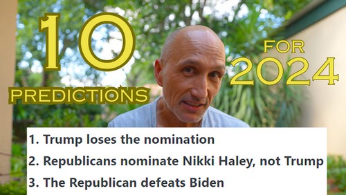
In my Annual Prediction Show, I review last year's predictions before making my new predictions.
Here are my 2024 Predictions
1. Trump loses the nomination
Yes, this prediction is almost as crazy as saying in 2015 that Donald Trump would be the next US President. Few believed that back then, and everyone assumes he will be the nominee in 2024. However, almost every election has at least one surprise, and I'm betting this will be the big surprise. I have low confidence in this prediction.
2. Republicans nominate Nikki Haley, not Trump
Who will represent the Republicans if Trump doesn't? Nikki Haley because Ron DeSantis lost his momentum. She is light years behind Trump, but if anyone can beat Trump, Haley can.
3. The Republican defeats Joe Biden
This prediction implies that Joe Biden will win the nomination, not Gavin Newsom (who would be a better candidate) or any other Democrat. If Trump runs against Biden, Biden might win. But any other Republican will defeat Biden.
4. Australian flooding will kill at least 50
This is a conservative prediction. Deaths could easily be in the hundreds.
5. Bitcoin doubles in value during a year of a halving
It will go above $80,000 during 2024 but won't close above $80,000.
6. Ethereum closes at $3333
Because everyone expects a bullish crypto year, I'm nervous that the crowd will (once again) be wrong. Still, it's hard to believe Ethereum will lose value this year, even with assaults from Solana and Bitcoin. Therefore, I'm making a moderately bullish prediction. I won't be surprised if Ethereum reaches $5000 at some point.
7. S&P climbs 7%
After a profitable 2023, the US stock market will likely cool off. Although a recession is priced in, not much other bad news is. Expect a modest year.
8. ANC will lose the majority of seats for the first time in 30 years
After spending 3 months in South Africa in 2023, it's clear that South Africans are fed up with the ANC more than ever. The main problem is that the opposition is fractured. A sloppy, chaotic coalition government will emerge with the ANC still the top dog despite its lack of majority.
9. Jimmy Carter dies
He's been in a hospice for nearly a year. His wife died in November 2023. I hope I'm wrong, but let's appreciate his final months.
10. I finish the manuscript of The Unseen Africa
I've been saying this often, but now I'm super determined. Plus, I finished the dreaded South Africa chapter, so it should be clean sailing for the next half of the book!
Previous predictions
To see my previous forecasts, check out my predictions for 2018, 2019, 2020, 2021, 2022, and 2023.
Share and put your feedback or predictions in the comments below!

Flying with a Tiny Tornado: A Survival Guide for Parents (and Other Passengers)
Ah, toddlers. Tiny humans with the volume knob cranked to eleven and the attention span of a goldfish on Red Bull. So, you're brave enough to take one on a plane? Buckle up, buttercup.
But fear not, weary warrior! Here's your arsenal for surviving (and maybe even enjoying) an airborne adventure with your mini-me:

Watch the three WanderLearn Shows featuring the entertaining Travel Tribe X Podcast Host Jordan Chmiel!
Subscribe to the Travel Tribe X Podcast on any podcast app, including Apple Podcasts and Spotify
How To Get Over the Fear of Living Abroad! South Korea Case Study
Travel Tribe X Podcast Host Jordan Chmiel exposes his secrets on finding the courage to live in South Korea when he hardly knew where it was.
Subscribe to the Travel Tribe X Podcast on any podcast app, including Apple Podcasts and Spotify
#southkorea #travel #livingabroad
Video
Podcast
Timestamps
00:00 Intro
01:00 1st lesson
08:00 2nd lesson
09:00 South Korea
Travel Tribe X Podcast Host Jordan Chmiel shares a hilarious true story when he acted like the two idiots in the final scene of the "Dumb and Dumber" comedy.
Subscribe to the Travel Tribe X Podcast on any podcast app, including Apple Podcasts and Spotify
Video
Podcast
Hammocks vs. Tents | SCUBA Diving | Ukraine & North Korea
Travel Tribe X Podcast Host Jordan Chmiel has tried hammocks & tents. He explains why he loves hammocks! We also dive into the SCUBA world. We end with current world hot spots.
00:00 Hammocks vs. Tents
05:15 Next Adventure
07:45 SCUBA Diving
14:30 Ukraine & North Korea
Video
Podcast
More info
To leave an anonymous voicemail that I could use on the podcast, go to SpeakPipe.com/FTapon
You can post comments, ask questions, and sign up for my newsletter at http://wanderlearn.com.
If you like this podcast, subscribe and share!
On social media, my username is always FTapon. Connect with me on:
My Patrons sponsored this show!
Claim your monthly reward by becoming a patron at http://Patreon.com/FTapon
Rewards start at just $2/month!
Affiliate links
Start your podcast with my company, Podbean, and get one month free!
In the USA, I recommend trading crypto with Kraken.
Outside the USA, trade crypto with Binance and get 5% off your trading fees!
Get a crypto hardware wallet from Ledger.
For backpacking gear, buy from Gossamer Gear.
- The Ideal Writing Space & Environment
- Cultures of Madagascar and Pakistan
- If the USA is Racist, Why Do Dark-Skinned Immigrants Come?
- Surprising Facts About Gorillas and African Wildlife
- When to End a Debate
- Unstoppable 70-year-old Adventurer Sym Blanchard
- Expats Raising a Family in Africa with Terry Repak author of Circling Home
- How Dangerous is South Africa's Drakensberg Traverse?
- Climbing Every Country's High Point with Eric and Matthew Gilbertson
- Can AI be wiser than humans?
- One of the World's Most Fascinating Travelers, Fabrizio Beverina
- Meditating When You Travel with the Isha Judd Meditation
- Bitcoin-Crypto-NFT Inheritance and Deadman's Switch with Pamela Morgan
- Bitcoin's Stock-to-Flow Models Haven't Failed Yet - 2023 Update
- Johnny Ward of One Step 4Ward on Everest, Poles, 7 Summits, & Every Country
- The Fate of Ukraine and Russia
- Hitchhiking on The Radio Vagabond
- Ukraine War 1st Anniversary Analysis
- Doing A Colonoscopy Without Anesthesia
- How To Overcome Obstacles with Vangile Makwakwa
- Why China's Rise Will Slow
- The Art of Admiral Nimitz's Command with Trent Hone
- Predictions for 2023
- Best Countries to Work Remotely
- Radio Vagabond's Global Adventure with Palle Bo
- 3 Best Amateur Traveler Episodes + 3 Favorite Places
- Students Fundraise with NFTs with FirstRoot.co
- Go to the Extraordinary Travel Festival
- 9 Shows Sharing Travel Wisdom Featuring Sym Blanchard
- Books About the Future
- 6 Questions for Episode 200: Scared, Motivation, Crypto
- Ukraine War Predictions July 2022 with Nejc Trušnovec
- All About Mozambique with Julio Maria Muhorro
- Traveling in Afghanistan and Pakistan in 2022
- Exploring Family Travel with Jocelyn Diaz
- Eczema: Epigenetics, Symptoms, & Treatment
- Why Abortion is NOT About Morality
- Bitcoin's Stock-To-Flow (S2F) 2022 Analysis + Price Prediction
- An Anonymous, Disposable Credit Card - Pay With Moon
- 3 Questions for Anti-Vaxxers
- What are financial bonds and inverted yields?
- Analyzing The Ukraine War
- Will Russia Nuke Ukraine? War analysis
- Buy Privately With a Virtual, Disposable Credit Card
- Spend a Semester at Sea - A Floating University
- Sandboxx Letters Review - Mail Military Recruits!
- Predictions for 2022
- The Best Gift You Can Give That Is Free
- Being a Black Non-African in Africa is a Culture Shock
- Thanksgiving in Gambia - What To Be Grateful For
- Gary Arndt talks about Everything Everywhere in 5 short shows
- Unseen Sides of Lesotho - A Peace Corps Perspective
- Empowa.io Cardano ADA NFT Boosts African Real Estate
- Hitler's War in North Africa with David Green
- Shooting Guns in the US Navy Bootcamp - M9 Firearm training
- How Long Could a Fugitive Hide on the Appalachian Trail?
- Are You Attached To Too Many Things?
- Will Our Descendants Take Down Statues of Meat Eaters?
- 10 Travel Lessons by Artist Mary Hunter
- Is The Food Industry Doomed?
- Why Do Animal Eaters Hate Hunters?
- An Empty Stomach is the Best Chef
- Are Some Cuisines Objectively Better Than Others?
- AMA - Book & Workout Recommendations + Eswatini
- The Underbelly of the Travel Industry with Room Steals
- Tips for Solo Female Travelers by Adrien Behn
- How to Film Better Video with Dan Coplan + NFT
- Bitcoin's Stock-to-Flow Model 1 Year After BTC's 3rd Halving
- Kosovo's Past and Future
- The Radiolab of Travel Podcasts - The Armchair Explorer
- AMA: Short episodes & My Upcoming Book
- AMA: Responding to Critics and Patrons
- 12 Misused Words and Expressions
- Transform Via A Paradigm Shift with Dr. Rosie Kuhn
- Which Military Branch Is Best For Medical Jobs and Careers?
- How is Bulgaria in 2021?
- Politics in Hungary and Eastern Europe
- Predictions for 2021
- Near Death on the CDT + Sym's 60-Year Love Story
- Cultivating Your Spiritual Atheism with Nick Seneca Jankel
- 1.5 Million COVID Deaths and 2021 Travel Plans
- Lucid Dreaming, Sub-Conscious, Aliens, Skepticism
- What To Be Thankful For This Thanksgiving
- Hal Urban on The Power of Good News
- Who I Am Voting For In The US 2020 Presidential Election
- Czechia vs. The Czech Republic - Name Debate!
- AMA: African Planned Cities, COVID, My Books in Academia
- 7 FAQs About Bitcoin Becoming A Country's Currency
- Circumventing the Globe Without Airplanes - Rambling Ryan
- Creating Digital Virtual Art with Garry Rone
- Random Facts About Everything That Take You Everywhere
- How a Family of 7 Traveled to 7 Continents in 9 months
- Are Hunters An Endangered Species Wonders Hunter of the Year
- NASA Astrophysicist Jack Lissauer On Tides & Terraforming
- What is a Reasonable Number of Unarmed Police Shootings?
- What If Earth Orbited Jupiter? A NASA Astrophysicist Answers
- 100th Episode! Special AMA!
- Reflections on COVID-19's 650,000 Deaths Worldwide
- Hunting Myths - Brittany Longoria Explains
- Peer-to-peer lending with Constant using cryptocurrency
Your comment will be deleted if:
- It doesn't add value. (So don't just say, "Nice post!")
- You use a fake name, like "Cheap Hotels."
- You embed a self-serving link in your comment.